
An easy-to-use online platform for harbour authorities to visualize, share, and utilize 3d asset data. Anywhere, anytime.
How to optimize asset management
The life cycle of a constructed facility can be hundreds of years, a lengthy period of time that contains different phases from planning to maintenance and finally decommissioning. The magnitude of information about the structure is almost unlimited, varying from design drawings and as-built survey data to maintenance procedures or inspection reports. There’s also a vast audience of stakeholders involved and the communication among them is crucial for efficient asset management.
There are many ways to manage all that information. The challenge is that most of the time, the information resides on different platforms. The architect has the drawings and maybe they are archived somewhere in paper format. The survey company has point clouds and in some drawer there is a flash drive containing the point cloud, but no one has managed to open it. The decision makers have never seen the damages the chief engineer is trying to address with the repair budget.
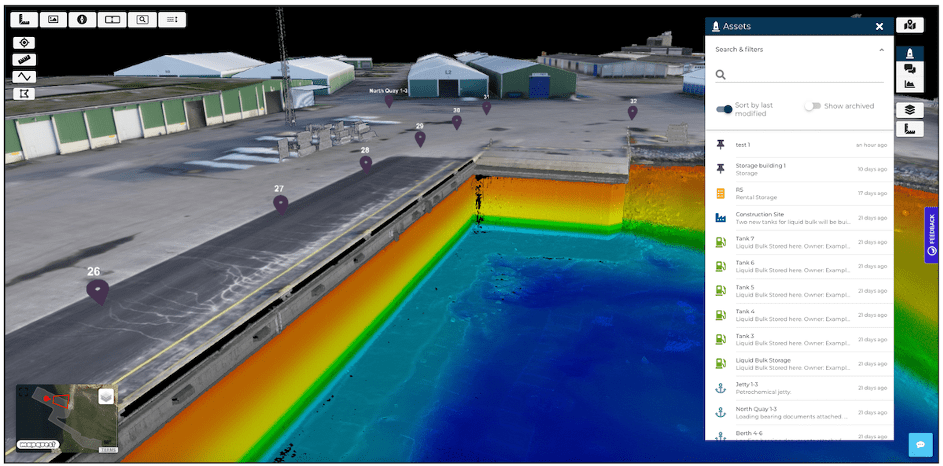
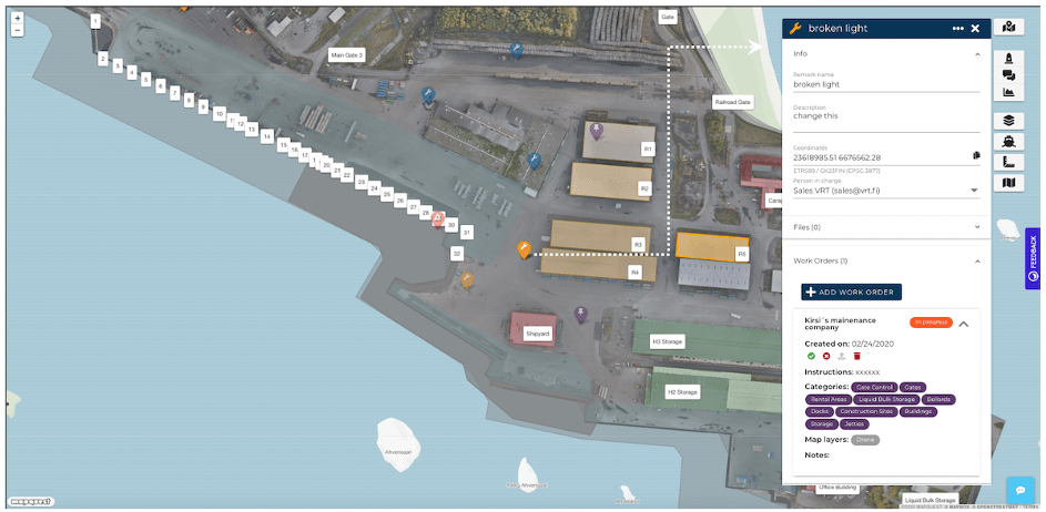
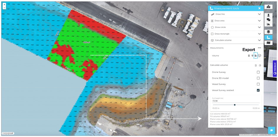
GISGRO is a web application that brings together 3D GIS visualizations and various life cycle management procedures. It creates a digital twin by making the data dynamically accessible. This digital representation can be used as a database, linking the 3D model of a structure in real coordinates with metadata such as inspection results, photographs, bathymetry, structural details or drawings. To schedule maintenance work, or to inventory damages and issue a call for tenders, you can simply take measurements directly on the structure from the 3D data. To demonstrate the condition of the structure to stakeholders, you can now easily show the visualized data in meetings via your web browser. You can manage daily maintenance using work orders, and access them in the field on a mobile device, directly from the web application.
For successful asset management, information is the key to making good decisions. And because decision makers cannot be experts in every field, the information needs to be available, accurate and easy to digest.
With GISGRO, you facilitate the best possible decisions by getting the most from an abundance of information.
Key features for asset managers
Digital twin of the asset
View, share, and utilize georeferenced 3D asset data in one place, online. Compare data sets, follow progress, optimize operations.
Cad data imports
Import CAD data, such as IFC data models, and utilize it in asset design, planning, and management.
 Data bank and remarks
Attach additional data, such as photos, CAD drawings, and documents. Mark/import assets, repair needs, and comments.

Communication in one place
Communicate with asset stakeholders directly through the platform, as an example, send work requests to maintenance.
Measurment tools
Measure distances and depths, do volume calculations, make cross-sections, draw polylines and polygons, and more!
 Data integrations
Integrate data from other databases, for example AIS-data to effectively plan vessel allocation in harbors.
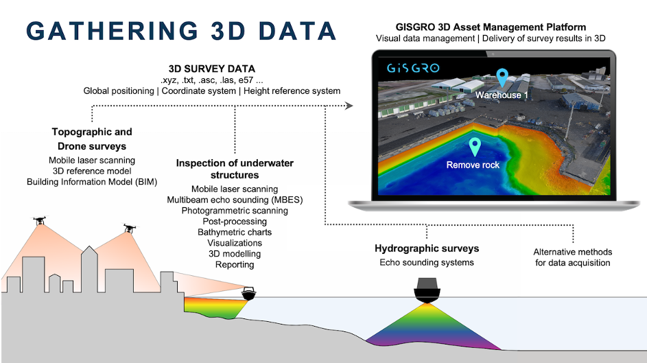
How to perform 3D inspections ?
For the ground part, we are able to deploy LiDAR UAVs to scan land and buildings.
For the submerged part, we can carry out multibeam bathymetric surveys to gather point clouds. In addition and for vertical structures such as quay walls, or for complex structures requiring centimetric measurement accuracy, we can carry out photogrammetric scans.
Deparentis is a COMEX representative and offers with ORUS3D a technologically advanced solution to perform 3D photogrammetric inspection of your submerged structures: using an ROV or divers, we offer another dimension to your underwater inspections.
Gone are the days of inspecting docks with divers equipped with cameras and plumb lines. Gone are the hours of tedious viewing with poor visibility, inaccurate measurements and paper plans. With modern technology in 3D, Deparentis offers another dimension to your underwater inspections.
Deployment is easy, secure, and the results are much more accessible simply and instantly through the GISGRO web application.
Want to know more ?
Discuss more about how GISGRO can help you optimize your asset operations by booking a 20-minute online demo with our 3D Asset Management Specialist. It is completely free and does not bind you to anything.
Discover the GISGRO presentation video:
![]()